Category:West Clandon
Jump to navigation
Jump to search
English: West Clandon is a village in Surrey, England. It is within 2 miles (3 km) of the M25 and the A3. Nearby villages include: Send, Ripley, Ockham, East and West Horsley. Local towns are Woking and Guildford.
village in Guildford, England  | |||||
| Upload media | |||||
| Instance of | |||||
|---|---|---|---|---|---|
| Location | Guildford, Surrey, South East England, England | ||||
| Area |
| ||||
 | |||||
Subcategories
This category has the following 5 subcategories, out of 5 total.
Media in category "West Clandon"
The following 200 files are in this category, out of 287 total.
(previous page) (next page)-
 2016, a year on Geograph (Day 307) - geograph.org.uk - 5177927.jpg 640 × 480; 50 KB
-
 A 246, Epsom Road - geograph.org.uk - 4137080.jpg 2,048 × 1,536; 1.14 MB
-
 A shapely tree - geograph.org.uk - 5888580.jpg 1,024 × 768; 310 KB
-
 A247 at St Peter And St Paul - geograph.org.uk - 2857692.jpg 640 × 428; 100 KB
-
 A247 closed at A25 junction - geograph.org.uk - 5888526.jpg 1,024 × 768; 382 KB
-
 A25, Shere Road - geograph.org.uk - 4137186.jpg 2,048 × 1,536; 1.31 MB
-
 A3 - 1-2 mile to Burpham interchange - geograph.org.uk - 2686972.jpg 640 × 428; 80 KB
-
 A3 - 3 miles to Guildford - geograph.org.uk - 2686926.jpg 640 × 428; 58 KB
-
 A3 approaching A247 bridge - geograph.org.uk - 2686922.jpg 640 × 428; 68 KB
-
 A3 near Burnt Common - geograph.org.uk - 4261492.jpg 640 × 425; 56 KB
-
 A3 towards Guildford - geograph.org.uk - 2686912.jpg 640 × 428; 74 KB
-
 A3, Burnt Common - geograph.org.uk - 4261495.jpg 640 × 379; 37 KB
-
 Access Road off the A25 - geograph.org.uk - 4137217.jpg 2,048 × 1,536; 1.71 MB
-
 Access road off the Shere Road - geograph.org.uk - 4137180.jpg 2,048 × 1,536; 1.54 MB
-
 Access Road to Nuthill Farm - geograph.org.uk - 6022934.jpg 1,440 × 1,080; 1.15 MB
-
 Access Road to Wellhouse Farm - geograph.org.uk - 6023140.jpg 3,648 × 2,736; 4.92 MB
-
 An empty car park at Clandon Park - geograph.org.uk - 5918017.jpg 640 × 480; 102 KB
-
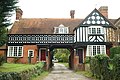
 Arch by The Street, West Clandon - geograph.org.uk - 5362302.jpg 1,728 × 2,304; 1.47 MB
-
 Autumn on Merrow Lane - geograph.org.uk - 1030954.jpg 640 × 480; 125 KB
-
 Avenue to West Clandon Church - geograph.org.uk - 1085789.jpg 480 × 640; 125 KB
-
 Barn at Tythebarns - geograph.org.uk - 1001421.jpg 640 × 480; 69 KB
-
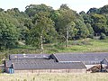 Barns at Old Scotland Farm - geograph.org.uk - 992368.jpg 640 × 480; 110 KB
-
 Barriers and Barriers - geograph.org.uk - 2731065.jpg 2,560 × 1,920; 1.68 MB
-
 Benches, Clandon Park - geograph.org.uk - 3626077.jpg 1,600 × 1,200; 856 KB
-
 Berry Bower - geograph.org.uk - 2729133.jpg 2,560 × 1,920; 1.65 MB
-
 Bones of a tree - geograph.org.uk - 5888549.jpg 1,024 × 768; 322 KB
-
 Bridlebridge on Green Lane - geograph.org.uk - 3839465.jpg 800 × 600; 193 KB
-
 Brown and Yellow Butterfly - geograph.org.uk - 3056535.jpg 1,753 × 1,409; 868 KB
-
 Bull's Head - geograph.org.uk - 2731031.jpg 1,920 × 2,560; 1.87 MB
-

-
 Bus stop on A3 - geograph.org.uk - 2686948.jpg 640 × 428; 70 KB
-
 Bus stop on Epsom Road south of Clandon Park - geograph.org.uk - 2810591.jpg 1,024 × 768; 255 KB
-
 By Old Scotland Farm - geograph.org.uk - 974826.jpg 640 × 480; 94 KB
-
 Carefree Pedestrians - geograph.org.uk - 3056382.jpg 4,288 × 3,216; 2.71 MB
-
 Central reservation on Epsom Road, East Clandon - geograph.org.uk - 4827835.jpg 2,048 × 1,536; 1.51 MB
-

-
 Clandon Downs - geograph.org.uk - 4137346.jpg 2,048 × 1,536; 1.33 MB
-
 Clandon Downs - geograph.org.uk - 992295.jpg 640 × 480; 97 KB
-
 Clandon Downs - geograph.org.uk - 992309.jpg 640 × 480; 89 KB
-
 Clandon Park - Angling Pond - geograph.org.uk - 5254086.jpg 2,560 × 1,920; 3.31 MB
-
 Clandon Park - geograph.org.uk - 3625279.jpg 1,600 × 1,200; 344 KB
-
 Clandon Park - geograph.org.uk - 3944476.jpg 2,048 × 1,536; 1.4 MB
-
 Clandon Park - geograph.org.uk - 6023139.jpg 3,648 × 2,736; 3.41 MB
-
 Clandon Park - WW1 Display - geograph.org.uk - 5251467.jpg 2,560 × 1,920; 2.4 MB
-
 Clandon Park estate - geograph.org.uk - 3868595.jpg 2,048 × 1,536; 1.29 MB
-
 Clandon Park in 1981 - geograph.org.uk - 5470658.jpg 1,024 × 651; 210 KB
-
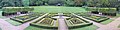 Clandon Park, Parterre - geograph.org.uk - 3660055.jpg 7,779 × 1,924; 3.09 MB
-
 Clandon Park, path to Garden Centre - geograph.org.uk - 3625392.jpg 1,600 × 1,200; 435 KB
-
-
 Clandon railway station, Surrey - geograph.org.uk - 3775291.jpg 1,024 × 768; 201 KB
-
 Clandon Regis - geograph.org.uk - 1085918.jpg 640 × 480; 128 KB
-
 Clandon Regis - geograph.org.uk - 281316.jpg 480 × 640; 187 KB
-
 Clandon Regis Golf Club - geograph.org.uk - 1085923.jpg 640 × 480; 126 KB
-
 Clandon Regis Golf Club - geograph.org.uk - 1085930.jpg 640 × 480; 122 KB
-
 Clandon Regis golf club entrance - geograph.org.uk - 4136689.jpg 2,048 × 1,536; 1.27 MB
-
 Clandon Regis Golf Course - geograph.org.uk - 1085936.jpg 640 × 480; 119 KB
-
 Clandon Regis Golf Course - geograph.org.uk - 1494864.jpg 640 × 428; 65 KB
-
 Clandon Road going north - geograph.org.uk - 3838857.jpg 800 × 600; 177 KB
-
 Clandon School - geograph.org.uk - 2729137.jpg 2,560 × 1,920; 1.82 MB
-
 Clandon Station - geograph.org.uk - 4362139.jpg 1,024 × 768; 203 KB
-

-
 Club House at Clandon Regis Golf Course - geograph.org.uk - 6023137.jpg 3,648 × 2,736; 2.42 MB
-
 Cones and Cones - geograph.org.uk - 2731071.jpg 2,560 × 1,920; 1.74 MB
-
 Coppiced area in Merrow Downs woodland - geograph.org.uk - 2999565.jpg 640 × 480; 207 KB
-
 Cottages in West Clandon - geograph.org.uk - 1085902.jpg 480 × 640; 117 KB
-
 Covered reservoir - geograph.org.uk - 4137202.jpg 2,048 × 1,536; 1.35 MB
-
 Covered reservoir - geograph.org.uk - 4137351.jpg 2,048 × 1,536; 1.38 MB
-

-
 Dean Bottom - geograph.org.uk - 993383.jpg 640 × 480; 95 KB
-
 Dedswell Manor Farm - geograph.org.uk - 2880926.jpg 2,048 × 1,536; 1.39 MB
-
 Dedswell Manor Farm House - geograph.org.uk - 2880910.jpg 2,025 × 1,517; 404 KB
-
 Dedswell Manor Farmhouse - geograph.org.uk - 3838873.jpg 800 × 600; 154 KB
-
 Difficult driving conditions - geograph.org.uk - 1167824.jpg 640 × 425; 92 KB
-
 Downland by Cotts Wood - geograph.org.uk - 1086573.jpg 640 × 480; 56 KB
-
 Downland Landscape by West Clandon - geograph.org.uk - 1086491.jpg 640 × 480; 86 KB
-
 Downland Landscape, West Clandon - geograph.org.uk - 1086493.jpg 640 × 480; 83 KB
-
 Drawing the Line - geograph.org.uk - 826715.jpg 640 × 480; 140 KB
-
 Dutch Garden, Clandon Park - geograph.org.uk - 3625877.jpg 1,600 × 1,200; 675 KB
-
 Dutch Garden, Clandon Park - geograph.org.uk - 3625897.jpg 1,600 × 1,200; 686 KB
-
 Electricity sub-station, The Street - geograph.org.uk - 1760913.jpg 800 × 600; 131 KB
-
 End of Lime Grove and Junction with Woodstock - geograph.org.uk - 6022783.jpg 3,648 × 2,736; 4 MB
-
 Epsom Road at the junction of The Street - geograph.org.uk - 4827821.jpg 1,974 × 1,430; 739 KB
-
 Epsom Road, West Clandon - geograph.org.uk - 2582782.jpg 4,320 × 3,240; 5.02 MB
-
 Ewbank's Auction Rooms - geograph.org.uk - 5950904.jpg 3,809 × 1,601; 408 KB
-
 Exit to Potters Lane on the A3 - geograph.org.uk - 2576088.jpg 1,600 × 1,200; 574 KB
-
 Farm buildings at Dedswell Manor Farm - geograph.org.uk - 3838888.jpg 800 × 600; 142 KB
-
 Farm track near West Clandon - geograph.org.uk - 3838034.jpg 800 × 600; 221 KB
-
 Farm track under railway bridge - geograph.org.uk - 3838892.jpg 800 × 600; 160 KB
-
 Farmland, Clandon Downs - geograph.org.uk - 4137716.jpg 2,048 × 1,536; 1.45 MB
-
 Farmland, West Clandon - geograph.org.uk - 2877835.jpg 2,048 × 1,536; 1.43 MB
-
 Field by Clandon Road - geograph.org.uk - 4286010.jpg 4,608 × 3,456; 5.01 MB
-
 Field by Tithebarns Lane, Burntcommon - geograph.org.uk - 4285237.jpg 4,608 × 3,456; 4.97 MB
-
 Field on chalk downland - geograph.org.uk - 4137668.jpg 2,048 × 1,536; 962 KB
-
 Field with a view - geograph.org.uk - 4137411.jpg 2,048 × 1,536; 1.33 MB
-
 Flooded footpaths by the golf course - geograph.org.uk - 3839046.jpg 800 × 600; 254 KB
-
 Flowerbed near Clandon Park House - geograph.org.uk - 3626106.jpg 1,600 × 1,118; 796 KB
-
 Folly and Horse - geograph.org.uk - 3944496.jpg 2,048 × 1,536; 1.58 MB
-
 Footbridge in Clandon Park (1) - geograph.org.uk - 3839021.jpg 800 × 600; 235 KB
-
 Footbridge in Clandon Park (2) - geograph.org.uk - 3839024.jpg 800 × 600; 233 KB
-
 Footbridge, Green Lane - geograph.org.uk - 2881030.jpg 2,048 × 1,536; 1.07 MB
-
 Footbridge, West Clandon - geograph.org.uk - 2881050.jpg 2,048 × 1,536; 1.44 MB
-
 Footpath above Wellhouse Farm - geograph.org.uk - 4137417.jpg 2,048 × 1,536; 1.79 MB
-
 Footpath along the hedge - geograph.org.uk - 4138161.jpg 2,048 × 1,536; 1.46 MB
-
 Footpath approaching Clandon Park - geograph.org.uk - 4135220.jpg 1,024 × 768; 169 KB
-
 Footpath at Clandon Park - geograph.org.uk - 6023130.jpg 3,648 × 2,736; 5.8 MB
-
 Footpath at West Clandon, Surrey - geograph.org.uk - 1494786.jpg 640 × 428; 90 KB
-

-
 Footpath emerging from woodland, Merrow Common - geograph.org.uk - 4134605.jpg 749 × 1,024; 171 KB
-

-
 Footpath going south from Highcotts Lane - geograph.org.uk - 3838867.jpg 800 × 600; 149 KB
-
 Footpath near Oldlands Copse - geograph.org.uk - 4189686.jpg 2,048 × 1,536; 2.77 MB
-
 Footpath reaches Shere Road - geograph.org.uk - 2810600.jpg 1,024 × 768; 305 KB
-
 Footpath through the grass - geograph.org.uk - 4137210.jpg 2,048 × 1,536; 1.29 MB
-
 Footpath to West Clandon Church - geograph.org.uk - 992288.jpg 640 × 480; 137 KB
-
 Footpath, West Clandon - geograph.org.uk - 2880947.jpg 2,048 × 1,536; 1.43 MB
-
 Glebe Cottages access road - geograph.org.uk - 4136687.jpg 1,957 × 1,467; 784 KB
-
 Gosden Hill Farm - geograph.org.uk - 2877805.jpg 2,048 × 1,536; 1.41 MB
-
 Gosden Hill Farm - geograph.org.uk - 2877807.jpg 2,048 × 1,536; 1.37 MB
-
 Gosden Hill farm - geograph.org.uk - 2877814.jpg 2,048 × 1,536; 1.41 MB
-
 Gosden Hill Farm - geograph.org.uk - 2877827.jpg 2,048 × 1,536; 1.39 MB
-
 Gosden Hill Farms - geograph.org.uk - 2877818.jpg 2,048 × 1,536; 1.41 MB
-
 Grazing by Merrow - geograph.org.uk - 2731076.jpg 2,560 × 1,920; 1.7 MB
-
 Green Lane - geograph.org.uk - 2880999.jpg 2,048 × 1,536; 1.35 MB
-
 Green Lane - geograph.org.uk - 2881011.jpg 2,048 × 1,536; 1.43 MB
-
 Green Lane - geograph.org.uk - 2881022.jpg 2,048 × 1,536; 1.45 MB
-
 Green Lane - geograph.org.uk - 6073402.jpg 768 × 1,024; 335 KB
-

-
 Grotto - Clandon Park - geograph.org.uk - 3625716.jpg 1,600 × 1,200; 836 KB
-
 Grotto at Clandon Park - geograph.org.uk - 5470879.jpg 1,024 × 641; 272 KB
-
 Guildford Manor Hotel - geograph.org.uk - 5950796.jpg 2,373 × 1,476; 434 KB
-
 Ha-ha, Clandon Park - geograph.org.uk - 3944485.jpg 2,048 × 1,536; 1.6 MB
-
 Hay There^ - geograph.org.uk - 1086488.jpg 640 × 480; 85 KB
-
 Hazlehurst Cottage - geograph.org.uk - 2881007.jpg 2,048 × 1,536; 1.45 MB
-
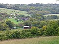
 High Clandon Farm - geograph.org.uk - 907595.jpg 640 × 480; 101 KB
-
 Highcotts Lane looking north - geograph.org.uk - 3838863.jpg 800 × 600; 221 KB
-
 Hinemihi, Maori Meeting House - geograph.org.uk - 5686328.jpg 640 × 481; 141 KB
-
 Horse Jumps - geograph.org.uk - 5254081.jpg 2,560 × 1,920; 3.13 MB
-
 House at West Clandon, Surrey - geograph.org.uk - 1494586.jpg 640 × 428; 97 KB
-
 House on Clandon Road, West Clandon - geograph.org.uk - 4285973.jpg 4,608 × 3,456; 5.11 MB
-

-
 Junction on Tithebarns Lane, Burntcommon - geograph.org.uk - 4285192.jpg 4,608 × 3,456; 4.79 MB
-
 L'auberge at the Onslow Arms, The Street - geograph.org.uk - 1760846.jpg 1,024 × 702; 238 KB
-

-
 Lime Avenue, Clandon Park - geograph.org.uk - 3625803.jpg 1,600 × 1,200; 678 KB
-
 Lime Avenue, Clandon Park - geograph.org.uk - 3625814.jpg 1,600 × 1,200; 818 KB
-
 Lime Grove - geograph.org.uk - 2880954.jpg 2,048 × 1,536; 1.34 MB
-
 Lime Grove, West Clandon - geograph.org.uk - 5362344.jpg 2,304 × 1,728; 855 KB
-
 Lodge at West Clandon, Surrey - geograph.org.uk - 1494630.jpg 640 × 428; 101 KB
-
 Lych Gate, West Clandon - geograph.org.uk - 2731041.jpg 2,560 × 1,920; 1.81 MB
-
 Major crossroads on the A25 - geograph.org.uk - 2810595.jpg 1,024 × 768; 229 KB
-
 Manor House Hotel near Newlands Corner - geograph.org.uk - 4855205.jpg 4,000 × 3,000; 3.48 MB
-
 Maori Carvings, Clandon Park - geograph.org.uk - 3660061.jpg 2,082 × 2,810; 1.31 MB
-
 Meadowlands, West Clandon - geograph.org.uk - 5950802.jpg 1,878 × 936; 193 KB
-
 Merrow Common - geograph.org.uk - 2843950.jpg 2,048 × 1,536; 1.42 MB
-
 Merrow Marker - geograph.org.uk - 826697.jpg 640 × 480; 148 KB
-
 Merrow Meadow - geograph.org.uk - 3056554.jpg 4,288 × 3,216; 3.53 MB
-
 Mistletoe - geograph.org.uk - 1085912.jpg 640 × 480; 168 KB
-
 Narrow Bridleway on the Clandon Downs - geograph.org.uk - 6023141.jpg 3,648 × 2,736; 4.47 MB
-
 Nearly dead tree, Merrow Common - geograph.org.uk - 2986918.jpg 640 × 480; 111 KB
-
 New Trees - geograph.org.uk - 147994.jpg 640 × 480; 83 KB
-
 New Zealand hut in Surrey - geograph.org.uk - 3604321.jpg 1,713 × 891; 431 KB
-
 Nuthill Farm - geograph.org.uk - 6023129.jpg 1,440 × 1,080; 1.06 MB
-
 NW corner of Clandon Park - geograph.org.uk - 5888571.jpg 1,024 × 768; 275 KB
-
 Oak Ride Farm - geograph.org.uk - 4189690.jpg 2,048 × 1,536; 2.74 MB
-
 Old Ford by West Clandon - geograph.org.uk - 1086502.jpg 640 × 480; 147 KB
-
 Old Milestone by the A246, Epsom Road, Clandon Park (geograph 5583702).jpg 740 × 1,024; 277 KB
-
 Onslow Arms, West Clandon. - geograph.org.uk - 140730.jpg 640 × 429; 137 KB
-
 Ornamental stands, Clandon Park - geograph.org.uk - 3944473.jpg 1,946 × 1,459; 957 KB
-
 Out of the woods, Clandon Downs - geograph.org.uk - 4137701.jpg 2,048 × 1,536; 1.23 MB
-
 Parterre, Clandon Park - geograph.org.uk - 3626096.jpg 1,600 × 1,200; 872 KB
-
 Path along Oldlands Copse - geograph.org.uk - 4189697.jpg 2,048 × 1,536; 2.87 MB
-
 Path entrance on The Street, West Clandon - geograph.org.uk - 5362317.jpg 2,304 × 1,728; 811 KB
-
 Path off The Street, West Clandon - geograph.org.uk - 5362304.jpg 2,304 × 1,728; 779 KB
-
 Poplars, West Clandon - geograph.org.uk - 2880986.jpg 2,048 × 1,536; 1.26 MB
-
 Pre-Worboys road number on Epsom Road, Clandon - geograph.org.uk - 3925424.jpg 2,560 × 1,920; 1.92 MB
-
 Pylon in the woods - geograph.org.uk - 2877823.jpg 2,048 × 1,536; 1.41 MB
-
 Pylon, West Clandon - geograph.org.uk - 2877843.jpg 1,965 × 1,474; 399 KB
-
 Railway Bridge - geograph.org.uk - 148009.jpg 640 × 480; 100 KB
-
 Red Brick and Orange Pyracantha - geograph.org.uk - 1494648.jpg 640 × 428; 72 KB
-
 Red phone box on The Street, Clandon - geograph.org.uk - 2680186.jpg 1,600 × 1,200; 587 KB
-
 Retail premises - geograph.org.uk - 3966753.jpg 2,048 × 1,536; 1.47 MB
-
 ROAD AHEAD CLOSED - geograph.org.uk - 3056364.jpg 4,288 × 3,216; 3.66 MB
-
 Road junction, West Clandon, Surrey - geograph.org.uk - 3340595.jpg 1,600 × 1,152; 410 KB
-

-
 Road works on A247 - geograph.org.uk - 2857717.jpg 640 × 428; 128 KB
-
 Roadworks, West Clandon - geograph.org.uk - 2731058.jpg 1,920 × 2,560; 1.56 MB
-
 Rustic Bark - geograph.org.uk - 1085801.jpg 480 × 640; 116 KB
-
 Snowy Clandon House - geograph.org.uk - 2917356.jpg 2,520 × 1,680; 402 KB
-

-
 Southbound A3 near Burpham Exit - geograph.org.uk - 4480426.jpg 640 × 480; 251 KB
-
 Southbound A3, Burntcommon - geograph.org.uk - 4480417.jpg 640 × 480; 230 KB
-
 Storm clouds near East Clandon - geograph.org.uk - 4137692.jpg 1,995 × 1,495; 869 KB
-
 Stream, Clandon Park - geograph.org.uk - 2729118.jpg 2,560 × 1,920; 1.66 MB
-
 Stubble field, Clandon Downs - geograph.org.uk - 4136705.jpg 1,937 × 1,452; 1.08 MB
-
 Stubble field, Clandon Downs - geograph.org.uk - 4137075.jpg 2,048 × 1,536; 1.41 MB
-
 Sun Valley - geograph.org.uk - 993398.jpg 640 × 480; 89 KB
-
 Sundial, West Clandon - geograph.org.uk - 2731047.jpg 2,560 × 1,920; 1.58 MB
-
 Telephone Exchange, West Clandon - geograph.org.uk - 2310901.jpg 3,072 × 2,304; 1.79 MB
-
 Temple Court - geograph.org.uk - 1085753.jpg 640 × 480; 69 KB
-
 Temple Court - geograph.org.uk - 3868373.jpg 2,048 × 1,536; 1.4 MB
_-_geograph.org.uk_-_5177927.jpg)


_-_geograph.org.uk_-_3839021.jpg)
_-_geograph.org.uk_-_3839024.jpg)


_Ltd,_Clandon_Station,_Surrey_-_geograph.org.uk_-_1494558.jpg)


.jpg)


